Info Type
View Option
Sort by Category
This text has been translated by auto-translation. There may be a slight difference between the original text and the translation. (Original Language: 日本語)
Notification
Alert Level 5 [Emergency Safety Assurance] issued* Assumed maximum flood inundation area
- [Registrant]市原市役所
- [Language]日本語
- [Location]千葉県 市原市
- Posted : 2023/09/08
- Published : 2023/09/08
- Changed : 2023/09/08
- Total View : 51 persons
- Find local business with Town Guide
-
- Internal Infrastructure Development ・ Le...

-
With the motto of "more comfortable business environment", we deal in a wide range of products such as OA office equipment, PCs, network cameras, steel products, stationery, etc. Hands-on Thinking t...
(0438) 62-6715有限会社トップシステム
-
- We provide customized treatments based o...

-
Hawaiian Lomi Lomi by the owner who has many years of experience working at resort hotels and total beauty salons. Lomi Lomi is a manual massage that improves lymphatic flow, relieves fatigue, and is...
Kekua
-
- Seikatsu Club delivers foodstuffs and da...

-
Why don't you enrich your life further with Seikatsu Club ? We not only provide shopping for daily necessities and foodstuffs, but also support for child-raising. We disclose information on producers ...
(043) 278-7172生活クラブ生活協同組合
-
- \ Okonomiyaki ・ Monja ・ Teppan-yaki / Vi...

-
KONAYA kamogawa, open near the seashore, offers the Osaka specialty ・ Precious Japanese beef oil cake is now available in Kamogawa ! We also use other special ingredients such as the Hayashi SPF brand...
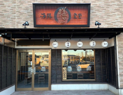
(04) 7007-5732KONAYA kamogawa
-
- Kisarazu Station East Exit ・ 5 min. walk...

-
Conger eel from Futtsu ・ white mil. Katsuura bonito ・ horse mackerel. Sea bream from Kamogawa. Kinmedai from Choshi. Clams ・ Stupid clams ・ ・ ・ from Kisarazu Banzu tideland. Seasonal Kaiseki course wi...
(0438) 22-4488四季味宴席たく
-
- We are a facility that is easy to use, e...

-
Our children's lessons are tailored to the level of your child. We offer a trial class for children, and if you are interested ・ in learning please join us ! For adults, we have an 8-course pool w...
(0438) 36-6221スイミングスクール ビッグ・エス木更津
-
- Finally OPEN🎊 ! A diner where you can en...
-
On 1/6, "Kaisen Shokudo Zen" is now OPEN🎉Open for both lunch and dinner! We have a limited number of lunch menu items available, so please come early if you are interested. Our recommended "ZEN Kaisen...
(0439) 29-5554海鮮食堂 膳
-
- If you are serious about improving the q...

-
Celebrities ・ Herbal peeling and REVI ceramic treatment, a hot topic among models, will make your skin beautiful ♪ Healing [dry head spa] is also popular ♪ The brain is the commander of the body. S...
(080) 1113-8181M HERB
-
- Newly opened at the store on February 19...

-
Newly opened at the store on February 19, 2023 ! We offer handmade set menus and boxed lunches in a homey atmosphere. Our signature dishes are croquettes and yakisoba. Please come and try our food ♪ W...
(070) 3876-9770手づくりおべんとうクロケット
-
- Pick-up and drop-off of your children ・ ...

-
There are many reasons why people use babysitters and housekeepers. At Fantasy Heart, we are available for any reason. We will support you to increase the number of moments that bring a smile to your ...
(090) 9149-5660ベビーシッター・家事代行 ファンタジーハート
-
- Sola st. is a select store featuring fas...

-
The light blue door is the landmark of this select store. ♪ In addition to the handmade goods sold in the store, there will also be a variety of stores selling sweets, alcohol, and other food and beve...
(04) 7092-4778Sola street
-
- If you are suffering from chronic stiff ...

-
A clean and comfortable clinic is located in the quiet environment of Mangoku, Kisarazu City. We are particular about the environment of the clinic, and provide an environment where you will be heal...
(0438) 40-4116やましん施術院
-
- Late night open ! Group reservation OK !...

-
For authentic Italian cuisine, gather at JOYs ! Authentic Italian cuisine that can be enjoyed until late at night ! Enjoy stone oven baked pizza and other dishes such as aqua pazza ・ A variety of fri...
(0438) 42-1075PIZZA DINING JOYs 木更津店
-
- Easy ! Convenient ! Pawnshop in your tow...

-
Gold and Platinum , Diamonds are expensive ! Of course, brand-name goods, precious metals and luxury watches are also welcome !.
(0438) 97-1768質SUDO
-
- Fried horse mackerel with a crispy and f...

-
In the summer of 2023, a restaurant specializing in fried horse mackerel opened in the mountains of Ichihara. In addition to our fried horse mackerels, which are carefully prepared so as not to leave ...
(0436) 63-5489フライデイ
Due to the rising waters of the Yoro River and the increased possibility of an emergency release of water from Takataki Dam, the Yoro River flood inundation area has been expanded to the maximum anticipated size, and at 13:00, an "Alert Level 5 Emergency Safety Assurance" was issued.
Lives are in imminent danger. ! Those who are in dangerous areas should immediately ensure their own safety by evacuating to higher ground.
The following evacuation centers are open: Anesaki Community Center, Yahata Community Center, Kokubunji Community Center, Chikusa Community Center, Miwa Community Center, Wettsu Junior High School, Tatsumi Community Center, Nanbu Health and Welfare Center ( Nanohana-kan ), Kamogakuen, Ariaki Community Center, Chiharadai Community Center Center.
[Note] Ichizu Community Center ・ Minamisou Community Center ・ Please note that Kamo Community Center will not be open as a shelter due to construction.
[Districts with evacuation information in effect]
Landslide Warning Area, etc.
"Warning Level 4 Evacuation Instructions"
All districts in the city
Flood Inundation Assumption Area
"Warning Level 4 Evacuation Instructions"
Murata River ( Ichihara ・ Ichizu district ) ← *Changed from "Shiitsu River ( Anesaki ・ Ariaki district )" in the first distribution.
"Alert Level 5 Emergency Safety" * Assumed maximum scale
Yoro River ( Anesaki ・ Ichihara ・ Goi ・ Miwa ・ Minamisou ・ Kamo district )